In lecture four Dr Victoria Kuttainen (2015) talks about how
maps
reflect how we see the world, this is true but it also effects what we
see. The Mercator map is a good example of a map with the purpose of navigation, this map
has the power lead people in the wrong direction and have people end up in places
the might not want to be in, seeing things they might not want to see .
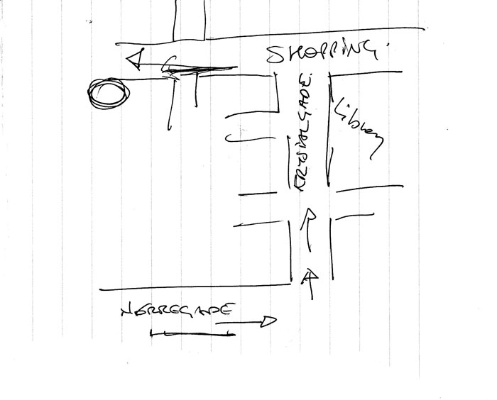
Wood, Kaiser and Abramms (2006, pp. 3) talk about the map
the guard made to show directions to an auto repair shop, the map fulfilled its
purpose and they arrived at the destination safely. That being said they could have easily been
miss led and arrived at a different location, after all they are trusting the
directions of someone they don’t even know.
Tumblr also has its own form of navigation but instead in
the form of a friendly guard and a hand drawn map it comes in the form of a
hashtag and a search bar. The ability to hashtag a post you make gives the user
the power to control how people find what they posted. A picture of an apple may
be hashtaged as #apple #red #fruit and a picture of a lady in a bikini may also
be hashtaged as #apple #red #fruit even though the colour red, apples and fruit are not
related to a lady in a bikini at all.
The community creates the navigation system, how trust
worthy is this community? How true are the maps? How trustworthy was the guard?
This brings me back to the word purpose, does Tumblr’s navigation system help
you find what you are looking for? Is the purpose fulfilled? In most cases yes
but you will most likely also find things you weren’t looking for. As mentioned
previously the community is in control of the navigation system and with all
that power you are bound to have people abuse it and unnecessary hashtags are a result of this misused power.
Denis Wood, Ward L. Kaiser and Bob Abramms.(2006).Seeing
Through Maps:many ways to see the world. UK: New Internationalist Publications.
Kuttainen Victoria.(2015) BA1002: Our space: Networks
narratives and the making of place, Lecture 4: Maps [Power point slides].
Retrieved from http://learnjcu.edu.au
Image:
Yoga Map(2009) Retrieved: http://www.handmaps.org/contributor.php?ID=brittany_shoot
No comments:
Post a Comment
Note: only a member of this blog may post a comment.